Share
During a Return on Investment Analysis carried out in Nottingham, there were many social and environmental benefits identified during the study that we were unable to quantify in the time available. Here we present some key examples:

Electoral registration
Electoral Services currently use the LLPG extensively for electoral register management. An interface has been setup which enables automatic background exchanges of information between the electoral system and address gazetteer. As access to electoral data is restricted, data cannot be directly cross matched with other systems within the council, so this link is particularly important in checking eligibility.
A significant problem for the department is receiving online registrations to vote that have incomplete or unknown addresses. This is a frequent issue for students, which form a large and constantly changing cohort of electors Cost and time savings are made by using UPRN data in the matching process. Over 100 hours of staff time is currently spent trying to fix and correct this problem each year A future enhancement is to work with the universities’ data systems to embed the UPRN.
Another significant benefit of having geocoded addresses is being able to allocate voters to their nearest polling stations. A lookup tool has also been developed by the GIS team to assist people in finding their polling stations using address data, reducing the need for frontline contact through enabling citizens to self serve.
Planning
The maintenance of the LLPG directly within the planning system ensures the UPRN acts as a comprehensive, complete and consistent identifier throughout the planning lifecycle. It is intrinsic in ensuring a comprehensive view of a property to underpin development management, building control, searches and street naming and numbering, with all relevant documentation and planning status information linked via the UPRN and available to relevant officers.
Fundamentally, this removes errors in data exchange and communication, and delivers efficiency gains in operational processes.
For example, for Street Naming and Numbering, the link via the UPRN to planning and building control ensures accurate information in the early lifecycle stages of development to facilitate property numbers and street names being issued in a timely fashion, with links to planning permissions ensuring any new or changes in permission are easily picked up by officers, and links to building control providing a trigger that development has commenced to prioritise caseload.
Climate change
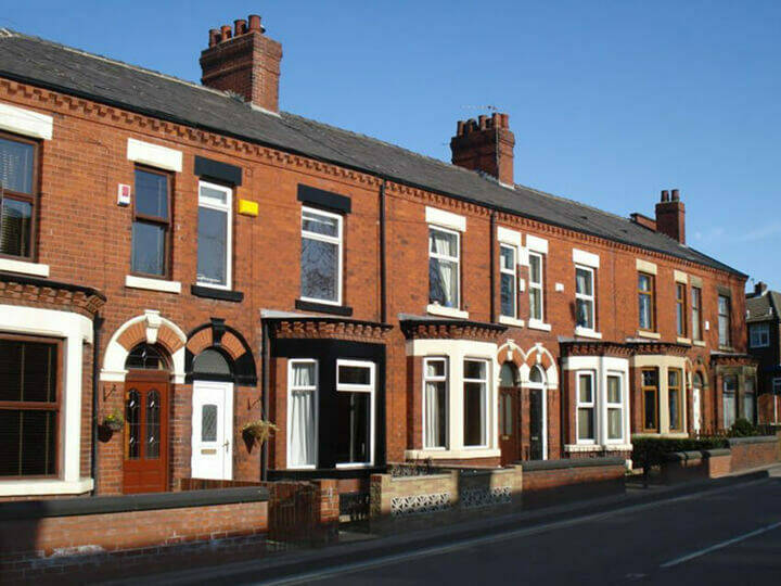
Climate change projections predict that substantial impacts on cities and human development in future Cities account for nearly 60 to 80 per cent of energy use and produce some 70 per cent of human generated greenhouse gases in the world. In the United Kingdom, most of the energy consumed in the buildings is used for heating, which is directly linked with their energy efficiency. Energy Performance Certificates (EPC) are the only information available publicly to analyse and compare the energy drive efforts towards energy efficiency and decarbonisation. However, EPCs are not available for all properties and the EPC databases have inconsistencies.
In Nottingham, work has been undertaken between the Carbon Neutral Policy Team and the GIS Team to look at how the use of the UPRN, as an essential link in bringing disparate datasets together, can aid the decarbonisation agenda and help to meet the 2028 carbon neutral target. This has resulted in the production of an EPC model, linking to other property datasets, such as council housing stock, housing licensing, Ordnance Survey building heights data and residential classifications within the LLPG. The Carbon Neutral Policy team is also building advanced machine learning models using UPRN linked property datasets to predict a buildings EPC score in the absence of a formal evaluation.
The use of these EPC property models has wide ranging use cases for insight and project development and has been integral in allowing for the identification of spatial clusters of domestic properties that have similar retrofit needs and criteria for grant funding, informing bids submitted to central government .Specific use cases include:
- Net Zero Neighbourhood proposal a dataset used to identify a long list of neighbourhoods in the city that meet funding criteria, and as evidence base to complete funding proposals. Without this dataset, this analysis would be constrained, and it is more challenging to put together an evidence based proposal focused on a neighbourhood retrofit approach.
- Use by Retrofit and Energy Assessor colleagues future use to help identify the likelihood of whether properties without an EPC would fall within the retrofit criteria for funded projects and prioritise EPC assessments accordingly.
- Use by Housing Strategy, Selective Licensing, Safer Housing colleagues future use of estimated EPC ratings to prioritise inspections at HMOs and Almshouses that may be incorrectly claiming EPC exemptions. Future use of estimated EPC ratings to use the data to help with identifying and targeting those properties with predicted low EPC scores for intervention in the private rented sector and seek, and if appropriate enforce, improvements to the property to ensure a warmer, safer property for the tenants.
This case study appears alongside several other case studies in a report on a return investment analysis that was carried out with Nottingham City Council.