Councillors work on behalf of their communities and have responsibilities ranging from:
- representing their wards, responding to residents’ enquiries and supporting casework
- contributing to the formation and scrutiny of the authority’s policies, budget, strategies and service delivery
- championing the causes which best relate to the interests and sustainability of the community
- campaigning for the improvement of the quality of life of the community in terms of equity, economy and environment.
At its heart, every local authority service uses address and street data to fulfil its remit. Your responsibilities focus on where your constituents live – and this means details about location hold the key to solving multiple problems:
Where are bins missed?
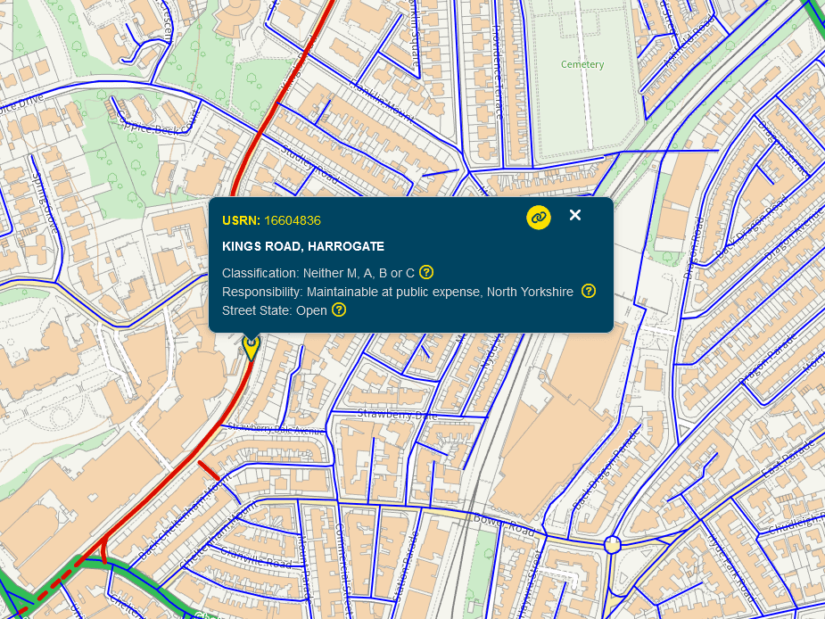
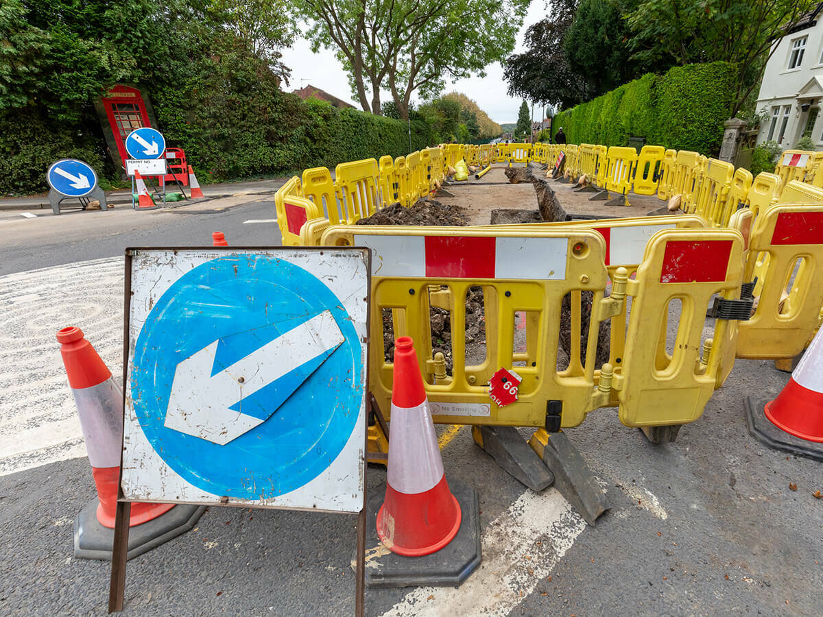
Where is the fly tip – is it on an adopted or an unadopted road?
Where is the faulty streetlight?
Where is the new planning application, will it impact on other nearby residents and who are they?
Where are all of the businesses in your ward?
Where are the council house tenants who need support?
Where are the hotspots of criminal activity and anti-social behaviour?
Where are the TPOs in your ward?
Where are the grass verges that need cutting?

A resource to help your casework
It’s your data, for your location
Did you know, every local authority in England and Wales helps to maintain the national address and street databases?
Local authorities are the first to know about local changes. That’s because they have the statutory responsibility for granting planning permission and the naming and numbering of new streets and properties.
Every local authority uses this information to help maintain a Local Land and Property Gazetteer (LLPG) and/or Local Street Gazetteer (LSG).
External Link
Find My Custodian
You have a Custodian who manages that data, daily. It’s your data, for your location, and you also have access to the experts who can show you how to use it.

How does location ‘work’?
Addresses and streets are located on the ground via precise geographic co-ordinates. Every address record in your authority contains a Unique Property Reference Number (UPRN) and every Street record contains a Unique Street Reference Number (USRN).
These unique references allow the various departments within an authority to tie all of its information together at the household or street level, revealing where and how to overcome both localised and authority-wide challenges. For example, data analysts use them to generate social progress indexes, target warm home grants, identify tall buildings and the like. They are also used for:
- Linking social care to housing needs
- Linking benefit claims to potential fraud
- Linking planning applications to efficient services
- Linking healthcare services to vulnerable people
Location information can show where the problems are and, in many cases, what the impact of changes in policy might be. It can be used for analytics, and to help promote key initiatives such as warm home grants, social care plans, tall building actions and emergency care.
Download
A guide for councillors
Download this intoduction to the benefits of address and street data. Find out what steps you can take next to take advantage of this free local resource.

Article
Supporting councillor’s casework
See how FindMyStreets to help with case work and better understand the status of roads in your ward and across your authority. Funded by the LGA, it’s a free resource for Ward Members.
Local authority resources
Find out more about location intelligence
This series of videos explains the value of address and street data for senior decision-makers who want to find extra value or deliver more benefits to their customers. Published by Socitm with sponsorship from GeoPlace and support from the LGA.

How are local authorities using UPRNs and USRNs?
Below are just some of the hundreds of case studies that GeoPlace has collected on how UPRNs and USRNs save money and help to deliver services better:
- Analysing property taxes to discover potential missing revenue, in North Somerset, Leeds, North and Mid-Wales, Salford, Bath and North East Somerset, Barnsley, Huntingdonshire and another case in Leeds.
- Identifying vulnerable people in the community who need targeted care in Barnsley and Hackney
- Reducing queries by residents by managing a single customer record in Brighton and Hove, Harrow and Camden
- Connecting datasets, sensors and operations – CCTV, road sensors, emissions in Hull
- Reducing the occurrence of potholes and footway defects, and to find and swiftly fix those which do occur in Kent
- Identify instances of fraud such as sub-letting within council properties and unlicensed privately rented properties in Huntingdonshire, Newham and another case in Newham
- Using drones to help monitor developments from the Local Plan in Milton Keynes
- Tracking home care allocations in Flintshire
- Record new low emission zones and making this data visible to organisations that undertake street works in Bath and North East Somerset
- Improving housing conditions for tenants and HMOs and people living in the private rental sector in Denbighshire, Sefton, Hackney
and more about Hackney.
- Waste management in Rhondda Cynon Taff, North Somerset, Wolverhampton, Oxford, Colchester, South Staffordshire, Reigate and Banstead and Northumberland
- Supporting democracy nationally
- Evidence based procurement in Bromley
- Digital transformation in Conwy, Walsall, Sefton, Wiltshire and nationally
- Transforming asset management to better manage systems in Conwy
- FixMyStreet; integrating the street gazetteer in Oxfordshire
For further case studies, visit our case studies area.
Video
Delivering health and social care
Local Authorities have a vital role in the communities in which we live. Beyond the very visible services such as waste collection and pot-hole response – one of the most crucial areas of responsibility is health and social care. The scale and rapid response required by all public sector bodies in response to the COVID-19 pandemic was unprecedented in recent times.

Blog
Driving healthier communities; alleviating congestion and improving traffic flow
Local councillors have a strong interest in alleviating congestion and improving traffic management due to its significant impact on the health, safety, and well-being of their communities. Read this blog about how GeoPlace and JAG(UK) are supporting local authorities.
VIDEO
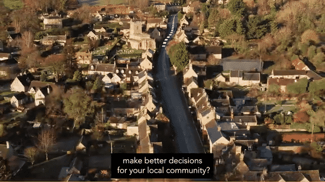
Everything Happens Somewhere
Custodians have the inside track on how you could connect up your data
What could the Return on Investment be for your authority?
Your local authority has free access to this data, and to resources that can help you derive more value from it.
Our case studies show how savings are made, how costs are brought down, where efficiencies are being derived, and how services are being improved across the board.
A recent independent cost-benefit analysis showed that wider adoption and use of this resource will generate £384m savings for local authorities in England and Wales over the period 2022-2026, particularly if it’s deployed in collection of non-domestic rates, highways asset management, adult social care, customer relationship management, waste management, used for data integration.
There may be investment needed in some service areas, and to integrate this resource across your authority’s systems – but those savings represent a Return on Investment of approximately 6:1.
GeoPlace can provide you with a free tailored Return on Investment analysis. It’s free. It takes five minutes, and it’s a good start to our conversation.
Easy wins for local authorities
Juliet Whitworth is the Research and Information Manager at the LGA. In her role she has a unique, informed perspective on the ‘easy wins’ with location data, from which many local authorities could quickly benefit.
Local authorities are working hard to deliver the high-quality services on which we all depend. It’s no secret, they’re thinly spread.
Local authority achievements to date deserve praise. And, while the focus is on delivering those front-line services ever-more efficiently, there’s still an appetite for improving the background research, inter-department liaison, and in-depth analytics that will make every part of each organisation’s work even more effective.
How we help you
As an example of how easy it is to access comprehensive, granular street and address information about your Ward, we’ve used the information from your authority to create two simple tools that help you see where problems are, quickly.
- www.findmyaddress.co.uk provides the location for every address and property in Great Britain. Use it to find those difficult addresses on a map
- www.findmystreet.co.uk tell you where a street is, what its official name is, and who’s responsible for its maintenance. See how it was used in Leicestershire County Council
These tools were created in partnership with and funding from the Local Government Association.
Comprehensive support
The LGA, GeoPlace and Ordnance Survey provide a wide range of free tools to help you find out more about how to get the most from your address and street data:
- The LGA’s ‘Find my local address and street Custodian’ tool shows you who your Custodian is
- GeoPlace’s UPRN integration tool reveals gaps in your authority’s capabilities, it shows which service areas should benefit from more-effective use of location data
- Use our checklist to see key action points to improve your integration capability
- Ensure your procurement of new systems supports UPRN integration by using GeoPlace’s new tool for the commissioning and purchase of new local authority systems’ software
- ROI assessment tailored to your authority. We’ll provide you with the potential ROI for your authority. Contact [email protected] for more information
- Personalised integration infographic - contact [email protected] to get one for your authority
- At a more technical level, the Ordnance Survey Data Hub includes an OS Places API which provides ‘out of area’ addresses, giving you full GB coverage if needed
Who is GeoPlace?
We are GeoPlace, a partnership that’s owned equally by Local Government Association and Ordnance Survey.
We’re responsible for working closely with local authorities to collate, manage and maintain the UK’s authoritative address and street data.
This data is available to you through your own Local Land and Property Gazetteer and Local Street Gazetteer or directly from Ordnance Survey through APIs. The street data maintained by local authorities is used by all organisations with a remit to undertake street and road works, to ensure coordination and appropriate permissions are given for street works.
Within the data, are the two identifiers –UPRNs and USRNs – which have also been released under Open Government Licence. The Open Standards Board has mandated the use of these identifiers across central government, for referencing and sharing all property and street information. This means all new public sector systems and projects that include address and/or street data should include these identifiers.
Government departments using them include: BEIS, Cabinet Office, CQC, DCMS, DHSC, DLUHC, DfT, DVLA, DWP, HSE, HMRC, Home Office, Land Registry, MoJ, NHS, Ofcom, Ofgem, OGP, VOA, Welsh Government.
Next steps: Talk to your Custodian
- Talk about UPRNs and USRNs – find out who knows how these location references which tie location and services together
- Support the teams that use this data – avoiding duplication and mistakes
- Create a culture of data sharing – encourage other colleagues to find out more about UPRNs and USRNs
Next steps: Talk to GeoPlace
Visit our case studies and guidance sections on our website on how other councils are using these resources to overcome fundamental problems in their authorities. We can also help you to surface the value from the street and address data that’s being maintained by Custodians in your authority.
The value of data
ROI of address and street data
A Return on Investment analysis assessing the value of address and street data to local authorities in England and Wales, 2022

Data in use
Government guidance
Central govenment mandates the use of UPRNs and USRNs. This is a collection of government guidance on best practice for using address and street data in your organisation.

Local authority resources
Find out more about location intelligence
This series of videos explains the value of address and street data for senior decision-makers who want to find extra value or deliver more benefits to their customers. Published by Socitm with sponsorship from GeoPlace and support from the LGA.
Data in use
UPRNs delivering health and social care
The scale and rapid response required by public sector bodies in response to the COVID-19 pandemic was unprecedented in recent times. The value of data about place has been vital to accurately provide efficient & effective service delivery solutions.