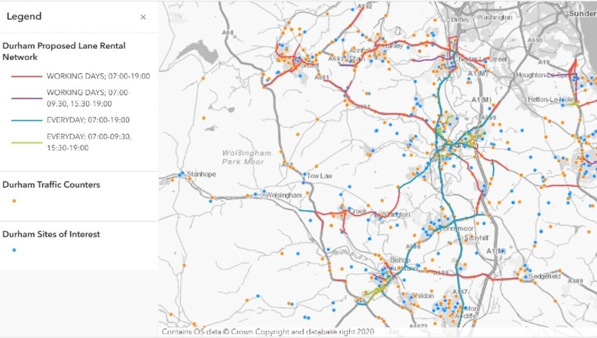
GeoPlace research commissioned by the Department for Transport around Traffic Regulation Orders (TROs) is a first step to creating an evidence base to open up TRO data.
This will enable tech firms to develop and enhance navigational apps powered by artificial intelligence. The apps could warn drivers up to months in advance of planned disruption to routes and offer alternatives, potentially saving them time and money.
Traffic Regulation Orders (TROs) are essential to the smooth running of the road network. By giving legal force to the restrictions that define roads, they determine the legal layout of the streets and help to define the streets of the future.
GeoPlace undertook a discovery into the process by which TROs are created, how this data is made available and used across the country.
By consulting with over 200 people from 92 organisations GeoPlace investigated:
-
whether better visibility of Traffic Regulation Orders and access to additional information and services can help improve the citizen experience and increase innovation around traffic control
-
if there was a growing demand for open, machine-readable Traffic Regulation Orders from users
-
how the TRO process is working
-
how to deliver the most from the current system and how to support the transport network of the future.
Introducing the report Nick Chapallaz, Managing Director of GeoPlace said: "TROs are an essential piece of national infrastructure data that need to be made available in a nationally consistent format. During the discovery, we worked collaboratively with local authorities who have a statutory obligation to create TROs and it is clear that they would value a review of legislation to increase the visibility of TRO information and reduce inconvenience to the public."
The research indicates that 400 authorities across Great Britain create 53,300 TRO and Temporary Traffic Regulation Orders (TTROs) annually to manage their road network at a projected cost of £126.4 million. Almost 90% of TTROs (Temporary Traffic Regulation Orders) are attributed to streetworks.
Nick continued "In this report we have made 23 recommendations under four key themes; Data, Legislation, Future of Mobility and Consistency. If adopted, we believe that they will enhance planning for the roll out of electric vehicles and electric vehicles charging points that the Department for Transport is championing and other innovations such as full fibre broadband and connected and autonomous vehicles."
In announcing the publication of the report, George Freeman, Future of Transport Minister said: "When councils and utilities plans works months in advance, why don't we tell drivers so that they can avoid roadworks? Today's announcement to work towards sharing Government data will reduce congestion, pollution and frustration."
Working with organisations including local authorities and the Connected and Automated Vehicle (CAV) sector, the Department for Transport will look at introducing legislation to make it easier for authorities, private app developers and companies to access data around the predicted 50,000 yearly road closures and use it to its full potential, and contribute to Government's commitment to make travelling cleaner and greener, safer, easier and more reliable.
The review will support the Government's Future of Mobility Grand Challenge â which aims to make journeys in the UK greener, safer, easier and more reliable - by considering whether current legislation is fit to meet potential future technologies. Evidence suggests that opening up TRO data could also help with route planning systems for self-driving vehicles.
NOTES:
The announcement from the Department for Transport is available at https://www.gov.uk/government/news/artificial-intelligence-to-end-future-holiday-jams-caused-by-roadworks.
The GeoPlace discovery report is available at https://www.geoplace.co.uk/trodiscovery.
About GeoPlace
GeoPlace LLP is a public sector limited liability partnership between the Local Government Association (LGA) and Ordnance Survey.
GeoPlace is a world class expert in address and street information management, working internationally as well as in the UK to help our partners and customers maximise the value of their spatial information for better decision making.
GeoPlace maintains a national infrastructure that supports the address and street information needs of the public and private sectors. Its work relies heavily on close working relationships with every local authority in England and Wales. This relationship has been developed over 15 years, to build the National Address Gazetteer infrastructure and National Street Gazetteer. Ordnance Survey develops the range of AddressBase products from the National Address Gazetteer and OS MasterMap Highways Network from the NSG. Both datasets underpin efficient and effective services, bringing direct service delivery benefits to users.
The Unique Property Reference Number (UPRN) and the Unique Street Reference Number (USRN) are the unique identifiers for every addressable location and street in Great Britain. They are created by local authorities who have the statutory authority to name and number every street and property and Ordnance Survey who identify objects on the landscape which may otherwise not attract an address.
These unique reference numbers link datasets together and share information with other organisations who also use them. They provide a comprehensive, complete and consistent identifier throughout a property's life cycle â from planning permission or street naming through to demolition.
See https://www.geoplace.co.uk.


