Share
GeoPlace has marked the opening of the Queen’s Platinum Jubilee week by mapping street and building names containing 'Queen', 'Jubilee' and 'Queen Elizabeth'.
This week, Her Majesty The Queen will become the first British Monarch to celebrate a Platinum Jubilee, marking 70 years of service to the people of the United Kingdom, the Realms and the Commonwealth.
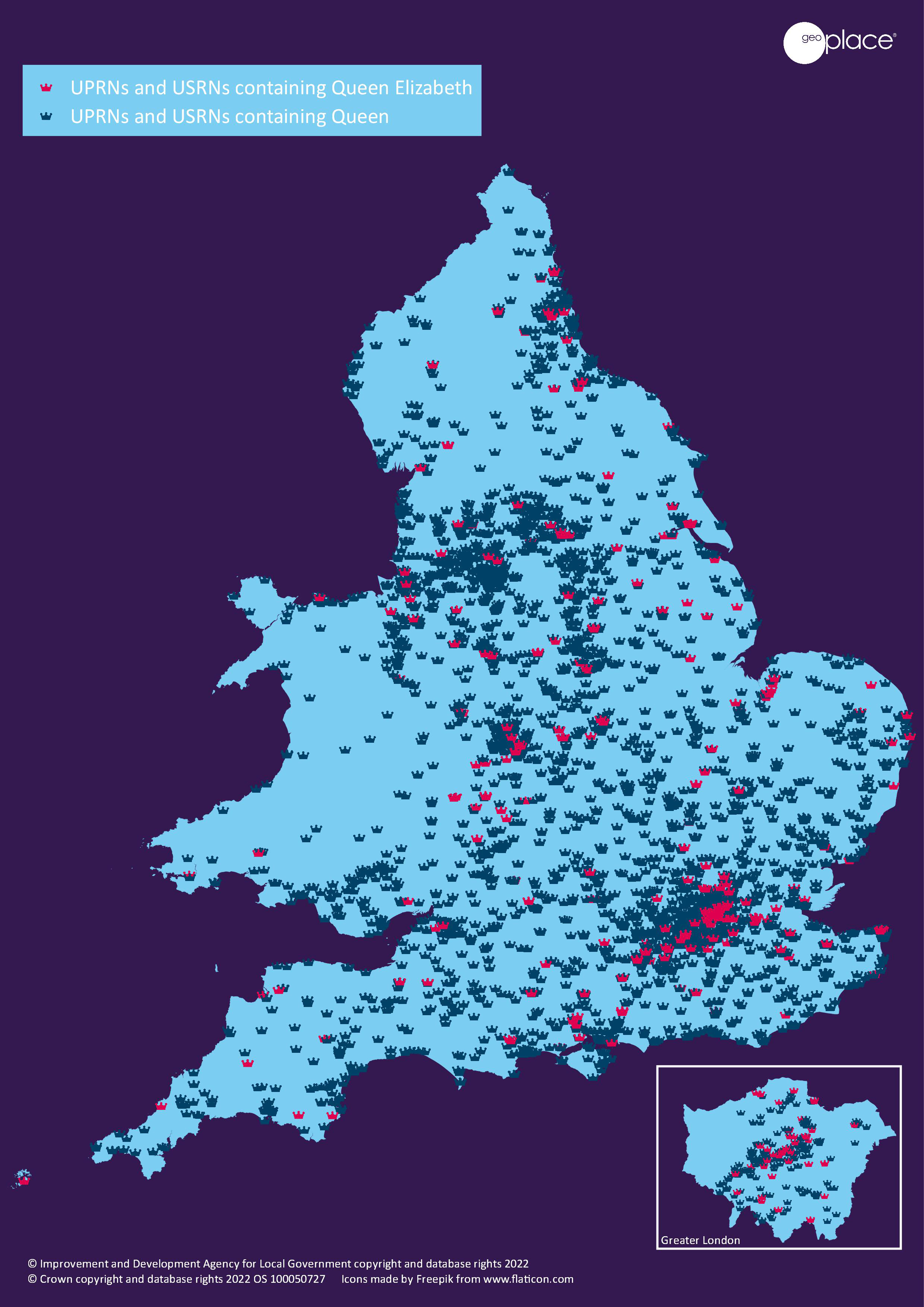
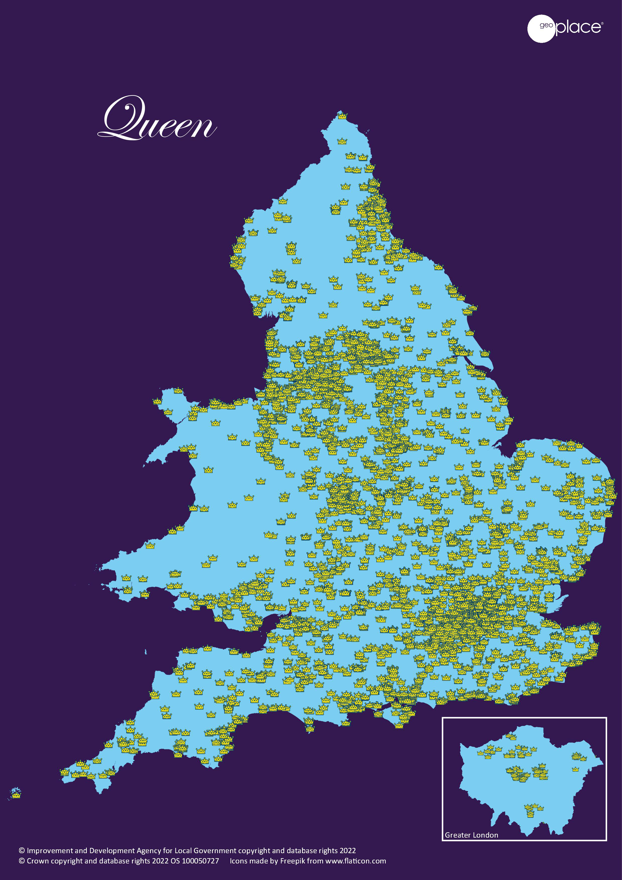
At GeoPlace we wanted to demonstrate Her Majesty's extraordinary impact on the country by mapping street names and properties relating to the Queen. We work with every local authority in England and Wales and local authority Address and Street Custodians from these authorities sent us names from right across the country that mark this historic event.
Using this data, we put together a series of visualisations using Unique Property Reference Numbers (UPRNs) and Unique Street Reference Numbers (USRNs), which are the unique numbers given to every property and street across the UK.
As well as these maps, we created an image of the Queen by joining together 6,787 UPRNs with lines (think of a dot-to-dot puzzle, but using properties instead!), with the Queens eye is centred on Buckingham Palace. On the ground, the image covers an area of over 544km2 and just over 695km in length.
We hope you enjoy these visualisations to kickstart your Jubilee celebrations!
The Queen UPRN dot-to-dot, by Luke Studden, Data Integration and Development Manager at GeoPlace (view higher resolution version):

The Queen map: the crown icons represent all streets and properties containing the word ‘Queen’ (view higher resolution version):
The Jubilee map: the Union Jack icons represent all streets and properties containing the word ‘Jubilee’ (view higher resolution version):

The Queen Elizabeth map: the red crown icons represent all streets and properties containing the words 'Queen Elizabeth'. The blue crown icons represent all streets and properties containing the word 'Queen'. (View higher resolution version):