Share
Local authority Asset Owner onboarding with NUAR

Marisa Hayes investigates the National Underground Asset Register and highlights some of the potential benefits of the platform.
The National Underground Asset Register (NUAR) standardises, centralises, and makes available privately and publicly owned data from hundreds of organisations about the location of underground utilities assets. NUAR is a secure, auditable, trusted and sustainable platform. It will provide a consistent, interactive digital map of buried asset data, accessible by those planning and executing excavations.

The fundamental purpose of NUAR is to streamline the data-sharing process, reduce the risk of potentially lethal utility asset strikes and promote more efficient management and maintenance of underground assets. It will also lead to enhanced communication between parties and improve data quality.
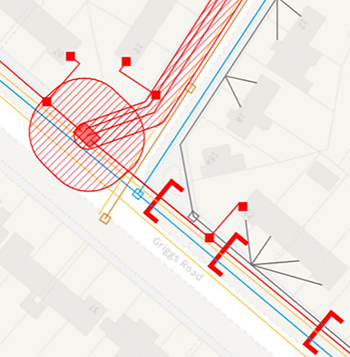
NUAR can now incorporate above ground assets too. Ranging from CCTV to tree preservation orders and environmentally sensitive areas, this provides the opportunity for all authorities to submit data and access the platform.
The minimum viable product (MVP) is a key, exciting stage in the design and development of NUAR involving real users as part of an interactive learning process to refine functionality and processes in preparation for business use. In line with the HSG47 ‘Avoiding danger from underground services’ guidance from the Health and Safety Executive, information about the currency and reliability of plans in general, and the requirements to carry out ground investigation and safe digging practices, is also displayed. Users of NUAR are already reporting significant advantages to the platform.
Ease of access to statutory undertakers’ plans: plan safe and dig safe – every time
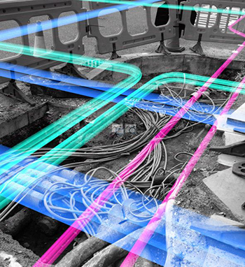
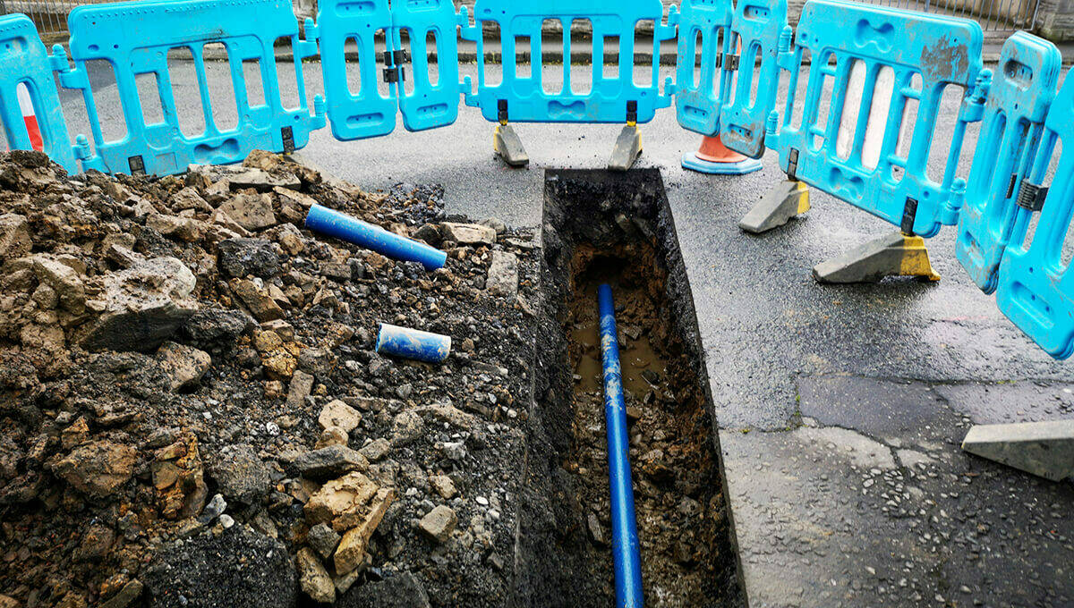
Statutory undertakers’ plans (stat plans) are required for every street works: a full set of drawings indicating the location of gas, electricity, water supply, sewerage, BT, other telecoms and cables, plus highway assets such as streetlight, traffic signals, etc.
As someone with past experience of stat plan requests for a highway authority, I can relate to the pain of requesting and waiting for plans. Hours, days and months will be saved for every piece of work taking place in/on the highway, whether it be planned improvements, routine maintenance or reactionary works.
For example, an authority sources data from three platforms, sends one email request and for certain locations request plans from two fibre providers.
Based on GeoPlace research, a simple estimate for a routine kerb replacement task approx. 350m stretch:
Identify the location of works (Eastings and Northings covering the whole site) |
10 minutes |
Type in Eastings and Northings; generate PDF plans x 3 platforms |
15 minutes |
Send an email with Eastings and Northings and wait for response via email with PDF attachment |
2 minutes plus response time |
Use internal resources to review highway assets such as street lighting, etc. |
10 minutes |
Collate PDFs, rename with source and job number, save in job folder for wider access. |
15-20 minutes |
Total |
50 minutes minimum |
And with NUAR: this task is reduced to 5-10 minutes. With the adoption of bookmarks in NUAR – all previously retrieved jobs can be refreshed at the touch of a button.
What next?
Ensure your authority’s assets are visible to NUAR users: contact the engagement team via the:
Read PART TWO of the blog here: Exploring the benefits for local authorities