Share
Government has ambitious house building targets of 1.5m new homes over the next five years.
Knowing where and when new property development happens, how many properties, are being built and where these properties are in the development process is becoming increasingly important in supporting a huge range of organisations in their work. Timely, consistent and accurate recording of property life cycle information enables measurement of the rate of house building, planning for services, ensuring utility connections, speeding up the conveyancing process and many other applications to support productivity, economic growth and sustainability.

GeoPlace has been working with local authorities for the last 25 years to create and maintain the authoritative index of properties in the UK. Data provided by local authorities from the Local Land and Property Gazetteers (LLPGs) is collated at GeoPlace into the National Address Gazetteer and published by Ordnance Survey in the OS AddressBase products and the new OS NGD suite of data. Key to this index is the application of a Unique Property Reference Number (UPRN) for every feature.
The focus over the last two decades has been on recording properties at the point they are given a formal address. This street naming and property numbering activity is statutory function of local planning authorities and can, for good reasons (eg the varied applicable legislation and differing business processes) result in street naming and numbering happening at different stages in the property development process. Sometimes, properties can be given their official address label at the start of the development process ie from the planning application, at the end of the process when the property development is completed, or indeed somewhere between the two. Increasingly, local authority services, government and the wider commercial market need access to information on property development earlier in the process to know when planning applications have been approved, when construction starts and when properties have been built and ready for occupation.

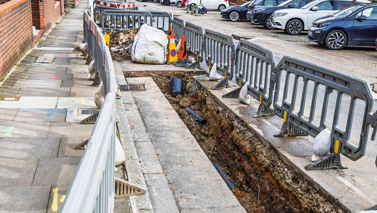
Gathering this early property life cycle information isn’t easy. The ecosystem of organisations involved in the development process is complex. Property developers, HMLR, local authorities planning and building control teams, approved building control inspectors, the Health and Safety Executive, the fire service are just some of the key organisations involved in the process.
Bringing these organisations together around a single authoritative property reference number enables the accurate identification, linking and sharing of data on development sites and individual properties and ensures that everyone is talking about the same property. This is important as properties are usually described in planning applications at plot numbers prior to street naming and numbering, so definitively referencing these plot numbers with UPRNs gives ability to track a UPRN through the development process regardless of whether it is described as plot or has been given its official address label.
Over the last couple of years, we have been conducting discovery work and engaging with key organisations in the development process to understand roles and responsibilities and requirements for property life cycle data.
The planning process starts with the local authority Local Plan. This provides a framework for development in a local area and are used to guide decisions on planning applications. The use of existing geospatial property information in developing Local Plans and the use of Local Plans more actively in automated planning decisions is a topic for a future blog post, so we will focus on when development activity starts.

The development process usually starts with the developer making a planning application. Not all planning applications result in approval or development, so spending significant time on recording every plot in every planning application made to a local authority is not an efficient use of resources when plans often significantly change between planning application, approval and subsequent development, some applications are not approved, amendments are often made prior to approval and some applications are not taken forward by the developer. Our discovery work indicates that the planning application approval stage is usually when plans have settled to a point where the development is recorded as close as it is likely to be when development happens on the ground.
Creating records in LLPG for the development site and each of the approved plots at the planning application approval stage gives each feature a UPRN. This UPRN and associated description and location can then be shared with the developer, the building control team or organisation and GeoPlace for onward publishing. This ensures we are all talking about the same property.
Once a planning application has been approved, the developer will apply for building control. Building control ensures that building work complies with minimum safety, accessibility, and energy efficiency standards. A developer can apply to the local authority building control team or apply to a registered building control inspector.
In higher-risk buildings (eg tall buildings), the Buildings Safety Regulator oversees building control. Building Control is underpinned by warranties and insurance by organisations like NHBC. Ultimately the local authority is the final repository for building control notices and certificates but due to the various channels for building control activity, there is often a time lag as to when paperwork is recorded with the local authority.
This application for building control is the next key life cycle stage to record as it indicates that development is likely or actually happening on the ground. Recording this application against the UPRN unambiguous sharing of this information.
There are various building control stages over the life of a development, but the next key point in the process is a building completion certificate. There are actually a few stages to this, but key is knowing when a property has finished construction and is fit for occupation. Again, this certification is managed either by the local authority building control team or by approved building control inspectors. Sharing UPRNs across this network of organisations enables completion certificates update the property index and to be shared more widely across all the organisations that have an interest in where developments are in the process.
With a persistent UPRN for each plot, street naming and numbering can then take place at any point in the process, adopting the plot UPRN against the formal address label when it is agreed.
As a result of our discovery work, we have recently improved the coding framework in our data standards to enable the consistent recording of planning application approvals, building commencement and building completion. This coding is published in the Data Entry Conventions Document which is used by local authority Address Custodians as the reference guide for maintaining LLPGs and we are supporting authorities in capturing this data.

We are also working with a number of other organisations to investigate whether change intelligence can be used to help local authorities keep this life cycle data up to date in as close to real time as we can. NHBC have been looking at adopting the UPRN across their data and sharing their information on building control applications and completion notices via GeoPlace to local authorities. This would help provide timely updates on development sites to local authorities, where building control is managed externally – reducing the time lag of recording building control activity.
We have recently connected with LABC (the representative body for local authority building control teams) with the aim of raising awareness in local government of the URPN and integrating building control more closely with local land and property address management. We are also participating in MHCLG work to digitise the planning system with the aim of including URPNs as part of the developing technical standards. Ultimately this will help accurately track developments and feed into the monitoring of house building targets. VOA have recently adopted UPRNs and the official address within their systems and knowing what developments are underway helps them plan for their valuation process.
Sharing and linking property life cycle information opens up new opportunities for efficiency and better service delivery. As significant area for improvement in data sharing is around higher-risk buildings. We have been working with the fire service and HSE looking at the recording of tall buildings with the aim of improving building control information exchange to avoid tragedies like we have seen at Grenfell Tower.
Local authorities can significantly benefit from up to date, consistent and accurate property life cycle information to help with strategic planning, policy development and monitoring, and service delivery efficiency.
The wider commercial market – utility providers, building insurance providers, mortgage lenders, conveyancers, the PropTech industry and many more – can also benefit from early intelligence on individual property development, supporting productivity and economic growth.
We will be running a session at the GeoPlace annual conference on the 22nd May 2025 which will focus on property life cycle data if you would like to know more and join the discussion. We are very pleased to have speakers from MHCLG’s Digital Planning Programme, the National Fire Chief’s Council, MadeTech Ltd (who have been working with local authority planning and building control teams) and Addland Ltd (who are sponsoring the session).