Share
As local street data is held and curated by dedicated officers in local authorities within Local Street Gazetteers (LSG), it’s important to ask why this key resource isn’t adopted more widely within each authority.

Local road funding remains a key concern for both officers and members. Balancing budgets, managing short- and long-term funding pressures, and meeting the growing demand for infrastructure all require sound evidence. Data sits at the heart of good decision-making — and the Unique Street Reference Number (USRN) sits at the heart of this process.
The value of the USRN is recognised by government and mandated for use by central government. GeoPlace has been working with the Department for Transport (DfT) and Ordnance Survey to establish a new local road funding process based exclusively on the USRN. Over the past three years, street gazetteer custodians in each highway authority have compared road lengths across systems, identifying missing links and connecting them to the classified network. As a result, DfT funding can now be more accurately aligned with the actual length of streets recorded in each LSG.
Embedding the USRN into wider operations offers even greater efficiencies. Customers can identify a street’s classification before applying for dropped kerbs or other highway interventions. Enquiries about private streets or the National Highways network can be quickly redirected. Inspections and maintenance reports can be linked to the USRN, creating clear, easily referenced records.
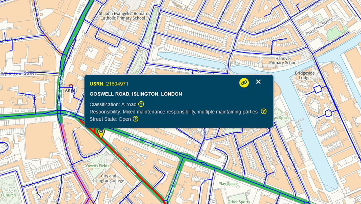
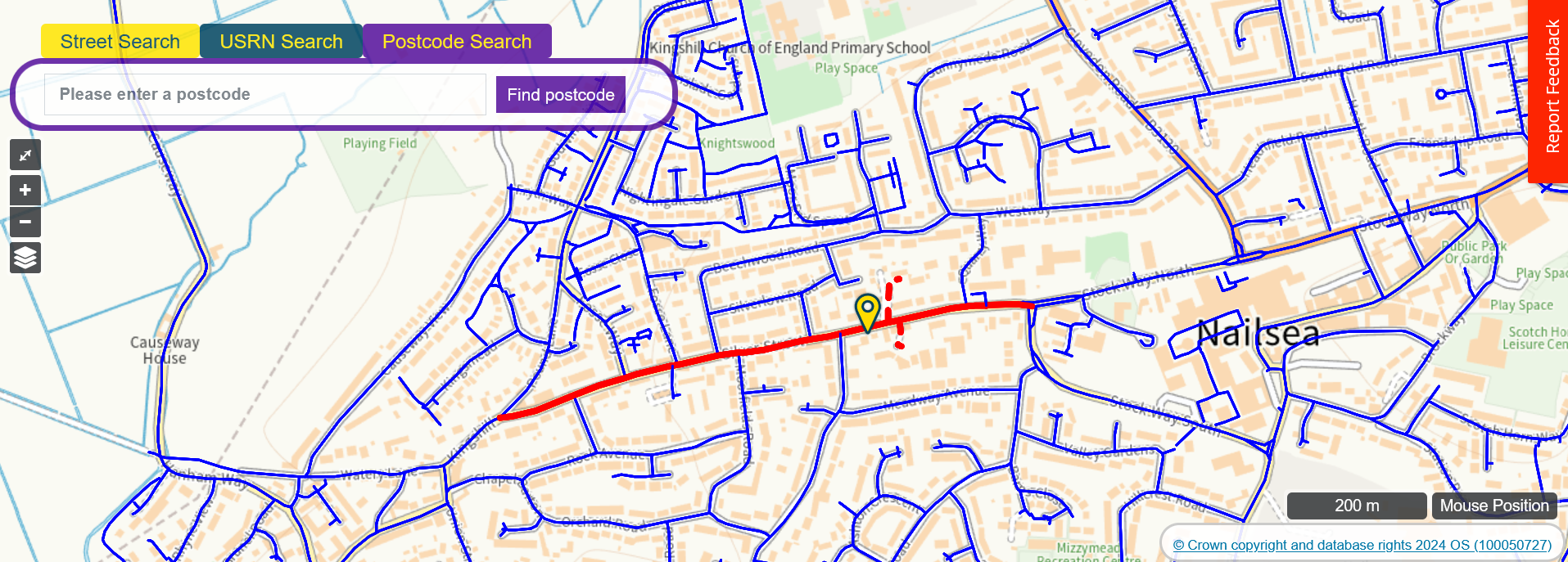
Many councils are already realising these benefits. Suffolk County Council, for example, has embedded FindMyStreet into its internal processes, using it as the authoritative, publicly accessible List of Streets maintained by their LSG Custodian.
GIS teams across the country are also harnessing the power of the USRN through GeoPlace’s DataVia API feed — available free to local government, thanks to support from the Local Government Association (LGA).
Custodians also work closely with Street Naming and Numbering and Address Custodians to keep data across gazetteers harmonised. GeoPlace continues to collaborate across local government to ensure new streets and addresses are captured early in the planning process — unlocking efficiencies and enabling essential utility connections to be planned well in advance.
As part of the global celebration of GIS, Gazetteers@GIS Day takes place on 19th November. You don’t need to be a technical expert to understand the value of the data that’s maintained within your own council. GeoPlace provides a range of resources to help you celebrate the day. We encourage you to connect with your Street Custodian and use the materials we provide to explore opportunities for integration, collaboration, and efficiency within your authority.
So, why isn’t this key resource more widely adopted? In many cases, it’s simply a matter of awareness and connection — the data already exists, is expertly maintained, and is freely available for use across councils. The USRN and the LSG are not just technical assets; they are strategic enablers for smarter planning, more efficient service delivery, and stronger evidence-based decisions. By embedding this authoritative data more widely across departments, councils can unlock significant savings, reduce duplication, and deliver better outcomes for residents. The tools and expertise are already in place — now is the time to make full use of them.