

Share
New Zealand’s global significance can be deceiving given its size and remoteness. However, the variety of topography including active volcanoes, high mountains, extensive floodplains, forests, and fast-growing cities means that for local authorities, the question isn’t whether geospatial matters – it’s whether its value to decision making is being fully measured, recognised by senior management and adequately funded.
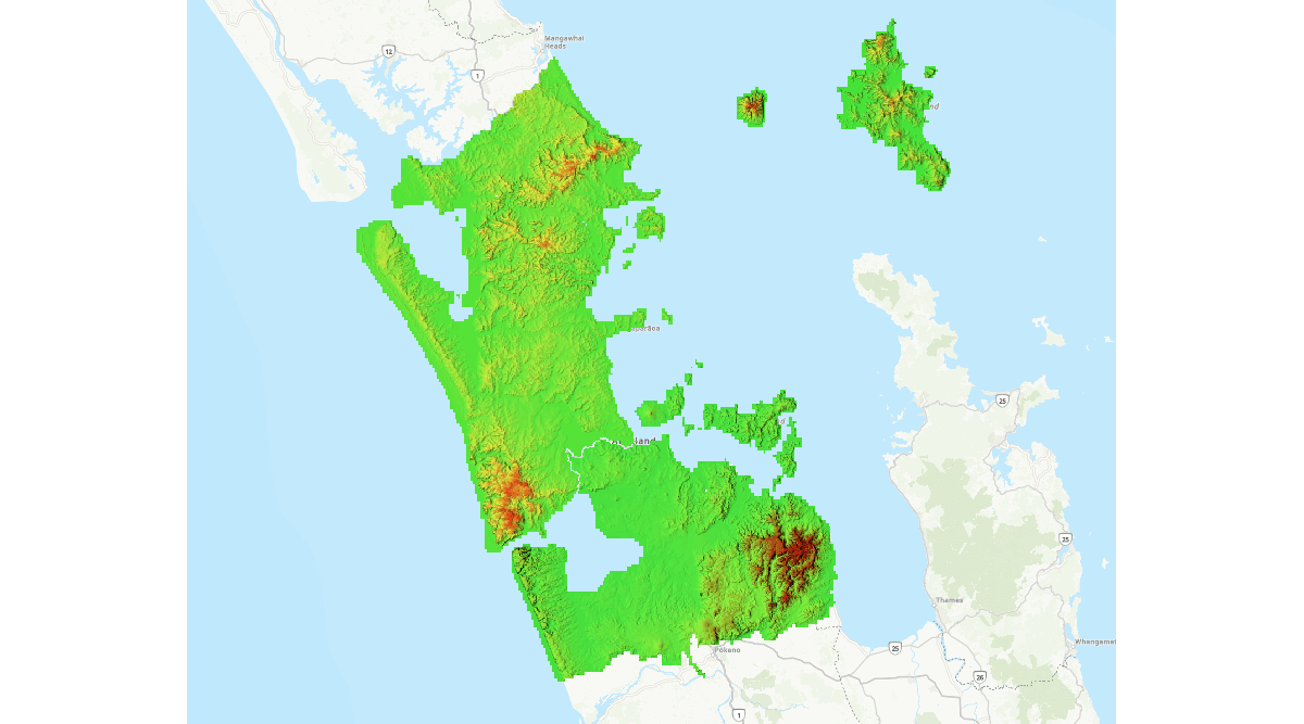
Auckland Council is New Zealand’s largest local authority, serving 1.65 million residents in 560,000 households. The challenge for Auckland Council is amplified by a landscape that combines rapid urban growth, environmental risk, and extreme demands on infrastructure. Spanning from the west coast to the east coast in under 60 minutes, Tāmaki Makaurau (Auckland’s Te reo Māori name) was ranked the world’s seventh most liveable city in 2025. But its striking natural beauty has a complexity: extensive coastlines, flash-flood risks, and 53 volcanoes around the wider region.
Forecast to deliver $4.3 billion of capital investment for the current 2025/2026 financial year, the council’s statutory 10-year Long-term Plan (2024-2034), is the cornerstone for decision-making. Much like plans of a similar nature in Britain, that strategy has to balance growth, affordability, and service levels for a vibrant multicultural community, all while funding diverse projects such as transport hubs, parks, and water facilities. Day-to-day services range from waste collection for more than a million households, to issuing consent permits for development and collecting council rates. The council also operates the public transport system and provides a wide range of local community activities and services.
Geospatial data and tools are integral to this work. Auckland Council supports over 3,700 users of its enterprise GIS and has nearly 200 GIS power users across its community of 12,000 staff across the Auckland Council Group, including council-controlled organisations.
These geospatial data and software tools support all manner of operational and governance decision making from planning and compliance to emergency management, risk mitigation, and environmental monitoring, and their uptake and adoption have been a success story. Key to that success, had been the ability to quantify Returns on Investment (ROI) in those technologies. Proving the value of geospatial and thus securing executive buy-in in the short term, and funding for the long term.
To reach its current state of capability, Auckland Council had to overcome several challenges that will be familiar to local authorities in Britain. Strategic growth was limited by a fragmented understanding of geospatial benefits. But with that in mind, Auckland partnered with Eagle Technology to conduct a comprehensive assessment of what could potentially be achieved, and how, and what the benefits to internal, external professional users and citizens was, and how this might be further enhanced in the future.
The study which was one of the most ambitious organisational-level studies of geospatial benefits ever conducted, tied geospatial value directly to Auckland’s long-term plan. It focused on cost reductions, risk mitigation, productivity gains, and improved decision-making, and particular attention was paid to high-demand data themes, such as building and property information.
Approach
The first step was a survey, designed to gauge the potential for geospatial, a baseline, from which a potential ROI could be calculated. To make sure its results ‘spoke the language’ of executives likely to read any resulting reports, Auckland Council and Eagle Technology designed a multifaceted questionnaire that carefully aligned its questions with the council's seven strategic pillars and legislative obligations.
Internal engagement targeted staff across the council’s various departments, while external outreach leveraged pop-ups on flagship platforms. This resulted in 15,000 unique external visitors and 40,000 sessions weekly, integrating authoritative GIS datasets, and open datasets, which expanded from 5 datasets in 2022 to over 235 today. More opportunities to engage data users were created in the margins, in digital environments where specialists were likely to be using or engaging with geospatial data. The result was a broad, informed, and attuned audience.
The survey garnered an impressive 1,045 responses, including 159 from internal staff and 886 from external users, segmented into professional (e.g., engineering consultancies) and personal (e.g., checking property valuations during revaluations). Those respondents were asked to rate geospatial tools' importance for workflows, compliance, and aspirations too – things like use of geospatial in or from high-resolution aerial imagery, historical data, and 3D visualisation.
Hypothetical scenarios evaluated the impact of geospatial in immediate terms (hours) or eventual outcomes (days), across criteria such as financial losses, legal risks, and threats to life, while a qualitative commentary provided ideas for improvement of current services and new use cases.
Outcome
The assessment delivered compelling evidence of the potential ROI and, more to the point, the ROI that might be achieved for Auckland Council. In short, the work transformed perceptions and is now driving positive action, too.
Internally, 84 per cent of respondents had cited essential or important productivity gains due to the use of location data, while 70 per cent viewed geospatial tools as essential for Resource Management Act compliance, with 14 per cent rating it very important.
An analysis of any failure in the geospatial systems also underscored the risks: emergency management topped the list, followed by stormwater (the management of storm risks in New Zealand), where threats to life might include misdirection of personnel into flood areas. Departments also highlighted financial and legal risks from disrupted routing, permitting, and monitoring, all the problems we see in the UK, and all challenges that can be better mitigated through the use of geospatial.
Externally, 74 per cent of professional users deemed geospatial essential for their workflows, with 17 per cent rating it important, and enabling enhancements for key sectors like construction.
With the results of this survey feeding into next steps for Auckland, these insights directly fuelled strategic investment, securing millions in funding for high-impact initiatives:
- high-resolution 2024-2025 aerial imagery across the vast Auckland region now enables change detection, reduces site visits and unpermitted activity, and makes it easier to integrate basemaps with 3.4 million views by September 2024
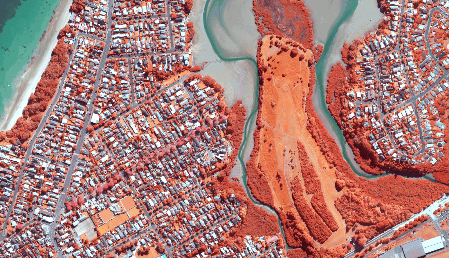
- near-infrared imagery for environmental assessments, identifying healthy vegetation (red tones) versus unhealthy or earthworks (blue), aiding arborists and compliance teams in detecting unauthorised constructions without permits
- historical aerial imagery supporting contaminated sites analysis (e.g., past land uses like horticulture), resource consent monitoring, wetland/stream reclamation detection, and environmental prosecutions
- region-wide 2024 LiDAR generating derived products like contours, and digital elevation models for elevation/slope analysis.
Summary
Auckland’s in-depth study not only improved an understanding of the potential ROI from geospatial, but it also facilitated major GIS platform upgrades. Executive sponsorship has shown marked improvement, as the survey results were shared publicly via LinkedIn by the director of Group Shared Services; internal comms and showcases did much to position geospatial as a point of pride for the organisation.
Broader promotion included conference presentations and official channels, which raised the profile for more potential partnerships and investments. This also amplified economic impact, demonstrating geospatial's value in a language of quantifiable returns.
“This survey was absolutely critical to secure funding for large initiatives. It helped us articulate benefits in a language executives understand, tying directly to our Long-Term Plan,” says Stevo Robinson, Auckland Council Product Owner.
Nathan Heazlewood Business Consultant at Eagle Technology who undertook the survey, commented on the value of these results.
“These results excite executives – 84 per cent see productivity gains, and 70 per cent view geospatial as essential for key legislation. It's powerful evidence for investment,” says Nathan Heazlewood.
Stevo Robinson echoed this sentiment, adding:
“GIS is now seen as one of the crown jewels of our organisation, with real buzz and recognition across the council. The engagement has opened doors to better collaboration and future innovations”
Video and transcript
Watch a video from the Auckland Council team reviewing the utilisation and benefits of GIS.
Read the video transcript here.
Thanks to the Project Team for this initiative:
Auckland Council: Dragos Bratasanu, Wendy Gomwe, Phil Lee, Stevo Robinson, Meena Ilamurugan & Olivia van Asperen. Eagle Technology: Nathan Heazlewood, Robert Mi, Anais Schaenzel, Merrisha Francis.

