Share
Developing an accurate population count for the 2021 Census in Manchester
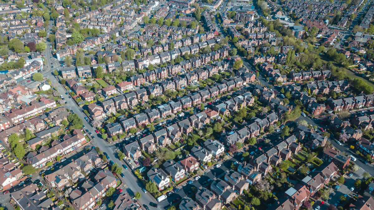
Manchester has a population of over 588,000 people who live in a wide variety of domestic situations.
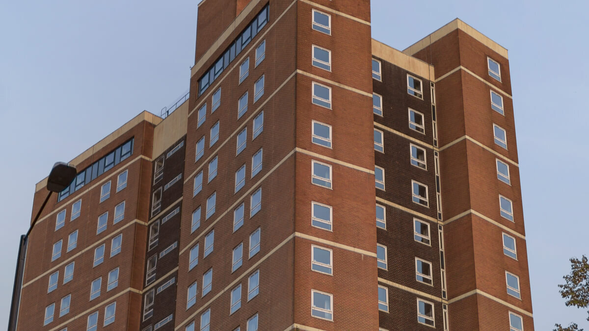
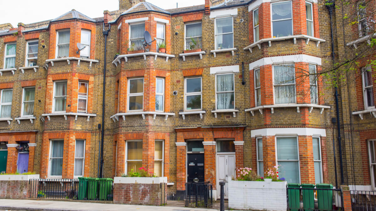
The 2021 Census needed to count the whole of the population, including hard to reach people such as residents in care homes, sheltered accommodation, supported living and occupants living in shared accommodation, such as houses in multiple occupation and students living in university halls of residence.
A large data collection project was undertaken to capture all the student halls of residence rooms. Along with a detailed investigation using third party data and cross council intelligence to verify, classify and enter communal establishment data into the Local Land and Property Gazetteer (LLPG).
This resulted in the addition of 25,000 student rooms being added to the council’s LLPG and the cleansing of 3,800 Houses with Multiple Occupants (HMOs), 231 care home, 231 halls of residence 4,650 sheltered accommodation units and 850 supported housing properties.
With many ward and lower level super output area (LLSOA) level maps being created to provide intelligence on the property type and property use within low census engagement areas.

The issue
With the 2021 Census approaching, the council wanted to improve its methodology and deliver a more accurate enumeration of Manchester’s population. Census data determines the financial settlement given to each council by the government, and is based on the number of addresses and the information obtained from the residents at those addresses.
Unfortunately, the 2001 Census had undercounted Manchester’s population by 25,700, due to 14,000 addresses not being included. This had a direct impact on the amount of money provided by central government to support those people; a deficit of approximately £7.5m. In 2011 the Census return rate exceeded the predicted return rate by 25,100 – and the council did not want these inaccuracies to be repeated.
For 2021, the Office for National Statistics’ Census team stipulated that UPRNs and Ordnance Survey’s AddressBase product should be used to facilitate more accurate enumeration. As part of that methodology, the Census team had specified that HMOs be allocated multiple UPRNs.
Multiple occupancy residences present a challenge for identifying accurate information. However, with the application of the UPRN, it became easier to work with datasets that looked at HMOs, sheltered accommodation, care homes, hostels, and supported living properties. The residents in care homes, sheltered accommodation and supported living may need assistance with filling out the online Census form, for example. Those properties need to be located and highlighted to the Census Field Officers, and correctly classified in the LLPG.
In addition, there are around 48,000 students living in properties that include purpose-built halls of residence and privately rented property; it is important to differentiate between single family households and multiple occupation. Manchester City Council wanted to improve its systems to provide a means for overcoming these challenges, and to give Census Field Officers the information they needed to accurately work with unoccupied and under construction properties, too.
Solution
In late March 2020 Manchester City Council contacted 156 student halls of residence with a request for information about student rooms (only non-personal and non-sensitive data was gathered). A strong return rate and more investigation confirmed the details of more than 25,000 student rooms in the area.
Using the Data Entry Conventions (DEC) to ensure the parent child relationships were correct, and referring to the DEC for the classification for each tier of the relationship hierarchy, the details of these addresses were formatted to BS7666 standard and added to the LLPG across 230 education residence sites. This intelligence was also uploaded to the national hub at GeoPlace to be provided to ONS via AddressBase. Properties classed as HMOs were verified through third-party data sets, such as Licensing and Council Tax. The Licensing data set indicated if the property was an HMO, while the Council Tax record indicated if the property was a student-occupied HMO. This categorisation was important, as many students were living away from Manchester at the time due to Covid 19.
A thorough investigation into each care home record was carried out, using intelligence from Adult Social Care and resources such as data from the Care Quality Commission. The record was then updated and classified so that it could be highlighted to Census Engagement Managers.
Sheltered accommodation, supported housing and hostel records were investigated using intelligence provided by the Neighbourhoods team. This information was compared with Council Tax records and other sources of information. Properties were reclassified to reflect use and flagged to the Census Engagement Managers as possible areas of low engagement.
When these properties had been verified, classified correctly and added to the gazetteer, a table of 42,000 potentially low engagement properties was created.
Ward and LLSOA level plans were also created, which provided easy-to-understand intelligence about the types of local properties that might result in low engagement. This enabled the Census Field Officers to focus on individual properties for their work – a transferrable skill that could be used in activities other than Census data collection.
To save the Census Field Officers time, a list of unoccupied and under construction properties was created. This involved extracting these properties from the LLPG and then using building control data, planning data, Council Tax data and information from developers themselves to ascertain if a property was empty, occupied or due to be occupied before Census day. Again, this data was helpful for Census Engagement Managers who could then reduce time and resources allocated to visiting what were unoccupied properties.
Outcomes and benefits
Every student room in an HMO was entered into the gazetteer by mid-October 2020, which enabled a more accurate count of the student population for Census 2021. In short, this work ensures that Manchester’s citizens can be better serviced and supported, as a more accurate financial settlement can now be provided by central Government on an ongoing basis.
Up to date population data also means that the council can create more accurate projections, run analysis with confidence, and take decisions that reflect future demands on services such as education and social services. Infrastructure, planning, and transport plans also benefit from having these more granular insights.
Manchester City Council was also able to provide Census Field Officers with ward and LLSOA level maps, lists of properties that were either under construction or unoccupied. This meant a reduction in wasted time and effort, and resources; it gave the Census Field Officers more time to focus their efforts on hard to reach individuals.
Overall, the team’s investigation into HMOs has improved the currency, accuracy and validity of the LLPG, which benefits the council as a whole.