Celebrating the people who keep the nation’s address and street data accurate, connected, and trusted
Every address. Every street. Everything happens somewhere.
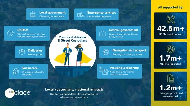
Behind the scenes, Address and Street Custodians work across local authorities to maintain the nation’s trusted geographic data — address and street data with its associated Unique Property Reference Numbers (UPRNs) and Unique Street Reference Numbers (USRNs). Their work ensures that essential public services, from emergency response to waste collection, can operate efficiently and accurately every day.
Gazetteers @ GIS Day is a chance to recognise these Custodians — the data professionals whose attention to detail keeps the UK’s authoritative address and street datasets current, reliable, and ready for use across government, the emergency services, utilities, and the private sector.
Video
Local Custodians, national impact
The heroes behind the UK's authoritative address and street data
Local heroes
Address and Street Custodians create and maintain local address and street data and ensure consistency between the records for their area.
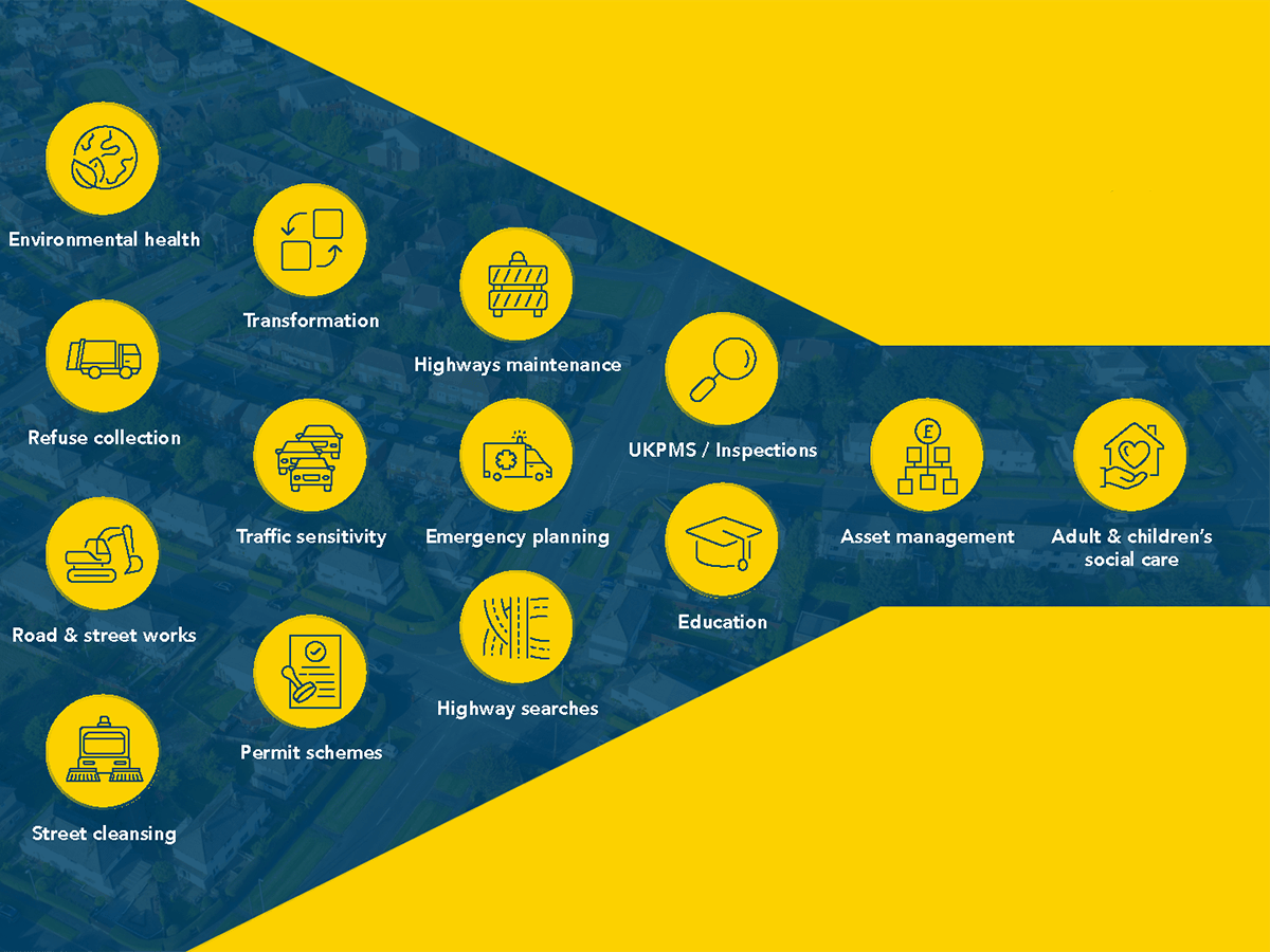
For local authorities, accurate address and street data are essential to delivering efficient, joined-up public services. UPRNs and USRNs link information across departments — from planning and highways to social care, housing management, and emergency management. This common data foundation reduces duplication, improves decision-making, and supports digital transformation.
By maintaining high-quality local data, Custodians help councils target resources where they’re needed most and provide better outcomes for residents and communities.
For the emergency services too, accurate geographic data is absolutely vital. A reminder of the great work that local authorities does in maintaining accurate addressing : “There is no doubt in my mind that accurate address data saves lives, probably every day”.
Why it matters
- UPRNs and USRNs link information across departments and services, enabling interoperability
- Custodians ensure data quality, consistency and adherence to standards, which helps avoid costly duplication, fragmentation or manual workarounds
- real-world benefits: quicker emergency responses, fraud reduction, stronger social care planning and improved data sharing across health, housing and third-party services
- it enables councils to ask: “What do we know about this address or street?” and get a single, authoritative answer—not a fragmented set of records
- accurate local data underpins national systems and policy decisions.
Video
Every UPRN/USRN starts with a Custodian
UPRNs and USRNs link people, places and services. Every services starts with a UPRN/USRN, and every UPRN/USRN starts with a Custodian.
Get involved
Join us in celebrating the vital role of Address and Street Custodians this Gazetteers@GIS Day.
Share your data infographics that we’ve prepared for you, highlight your team’s achievements and help raise awareness of the value of your high-quality local data that supports national outcomes. And join us on 19th November for a Teams quiz - email [email protected] to sign up.
Street naming and numbering officers
Every property, street, and building in the UK relies on accurate addressing — and that starts with Street Naming and Numbering (SNN). We've put together videos, infographics and interviews to resource SNN Officers for Gazetteers @ GIS Day.
Make confident decisions with UPRN address data
This Ordnance Survey video explains what UPRNs are, and their central importance in decision making.
Resources
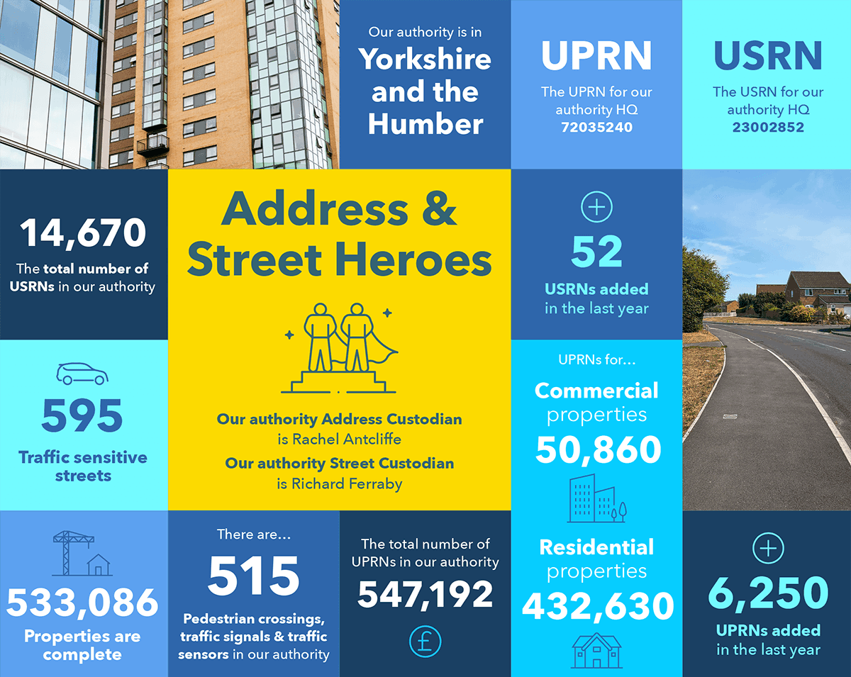
Your personalised infographics
Your Address Custodian and Street Custodian have been sent a series of infographics displaying a snapshot of the data that your authority holds.
Why the LGA supports Custodians
Find resources from the Local Government Association (LGA), which recognises that Address and Street Custodians are vital to helping councils manage and use their data effectively.

Gazetteers @ GIS Day
Street naming and numbering resources
Gazetteers @ GIS Day is also an opportunity to recognise the vital contribution of Street Naming and Numbering (SNN) officers.

How to guides
Local government reorganisation
Here’s how understanding and linking to place through location data can make the local government reorganisation process easier for decision-makers, and why local authority Street and Address Data Custodians are key to local government reorganisation success.

Gazetteers @ GIS Day
Endorsed by leaders
Discover videos from senior politicians, managers and practitioners in local authorities and central government.

28th November 2024
Best kept secret: unlocking the hidden value of your data
On its own, the data in your systems is limited and only really of value to the service that collected it. But by linking the data, via this location information, you can increase the efficiency of processes as well as gain more insight about your residents and business, in order to target resources more effectively.
Gazetteers @ GIS Day
LGA & government guidance
Find out about mandated use of the UPRN and USRN, and access government guidance.

Data integration tools and procurement advice
Find resources to help local authorities to specify and procure effective systems for integrating the UPRN and USRN into their service delivery.

Gazetteers @ GIS Day
Your ROI from data integration
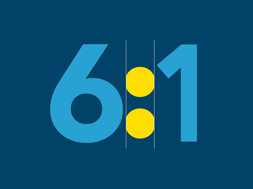
Discover how you can get a ROI of 6:1 through integrated your data