Share
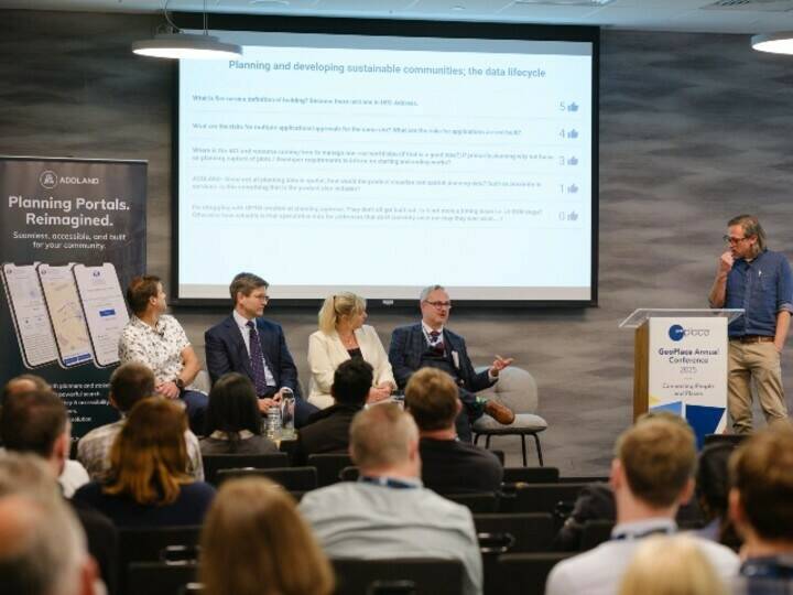
Opening address - Sarah Hodgetts, Director of the National Data Library and Geospatial at the Government Digital Service (GDS), opened the GeoPlace Conference 2025 by speaking about shifts at the heart of government.
Recordings of the 2025 conference talks can be found here
SPEAKERS:
- Sarah Hodgetts, Director, National Data Library and Geospatial Government Digital Service
- Rob Lee, Chief Data Architect, HMRC
- Ben Crampton, Senior Data Scientist, Bank of England
- Gordon Hector, Director, Upstream
Opening address
Sarah Hodgetts, Director of the National Data Library and Geospatial at the Government Digital Service (GDS), opened the GeoPlace Conference 2025 by speaking about shifts at the heart of government. Reflecting on the past year, Sarah highlighted that geospatial responsibilities have now moved under the umbrella of the Government Digital Service (GDS), widely known for managing gov.uk, the central platform for citizens to access government services.

"This is a very exciting time at the heart of government," Sarah emphasised, noting that geospatial’s new placement within GDS signals a strong acknowledgment of its crucial role as foundational infrastructure within the broader digital and data landscape. The consolidation, brings together units primarily from the Cabinet Office and the Department of Science, Innovation and Technology, creating what Sarah described as "a powerhouse at the centre of government."
She outlined that ministers have set clear goals for the revamped service, targeting five key outcomes:
1. easier lives
2. faster growth
3. firmer foundations
4. smarter organisations
5. higher productivity and efficiency
These goals are underpinned by a six-point digital reform plan, prominently featuring the enhancement and extension of public digital and data infrastructure.
Sarah stressed the increasing importance of geospatial data, recognising it as indispensable to effective decision-making across government. She described her transition to leading a new team responsible for delivering the National Data Library, further reinforces government's renewed emphasis on authoritative, foundational data.
Addressing collaboration challenges between central and local government, Sarah pointed to recent efforts with Theo Blackwell, London's Chief Digital Officer. Blackwell recently completed a three-month initiative aimed at improving data sharing practices between central government and local authorities, acknowledging past shortcomings.
In terms of ongoing geospatial projects, Sarah noted the government's continued custodianship of the Public Sector Geospatial Agreement (PSGA), which centrally procures mapping data for public sector use. Additionally, she highlighted active local government collaboration initiatives aimed at boosting the adoption of Unique Property Reference Numbers (UPRNs)—a critical step in standardising data across government entities.
Sarah concluded her remarks by drawing attention to another significant initiative: the National Underground Assets Register (NUAR), which has recently been transitioned successfully to Ordnance Survey for implementation. She encouraged attendees to stay engaged with these developments, signalling a promising new era of data-driven governance.
Driving address data interoperability
Rob Lee opened his session with the admission: most people in government have never heard of UPRNs. Yet for HMRC, he argued, the Unique Property Reference Number is quietly becoming indispensable. Rob, who works on data strategy at HMRC, explained that the real challenge isn’t geography, it’s connection. “This isn’t a mapping problem,” he said. “It’s a data problem.” In his view, everything the department needs to understand about properties—from ownership to use—depends on linking scattered datasets, and UPRNs offer the key.

Rob illustrated the point with a personal anecdote. When his son tried to get broadband at a flat above a tanning shop, the provider refused: the address didn’t exist in their system. Only when a UPRN was provided did the property become ‘real’ to the database. A small example, but emblematic of a much bigger issue. At HMRC, the team routinely works with multiple datasets: council tax, licensing, rental listings, planning. Each comes with addresses—but no two in the same format. “You’ll see postcodes missing, street names rearranged, even entire fields mislabelled,” Rob said. “You have to make assumptions to link them, and those assumptions break down at scale.”
By attaching a UPRN to each address record, HMRC can eliminate ambiguity and reduce duplication. That, Rob argued, is what turns patchy address data into a dependable foundation for analytics. “It’s just one number, but it gives you traceability and confidence.” Work is already underway to retrofit systems across HMRC. A key step has been ensuring core platforms include a field for UPRNs. For legacy systems, even that can be a challenge. “We ask the question: can this system store a UPRN? That’s where we start.”
Progress is incremental. Incoming data is often unstructured or even handwritten, meaning manual intervention is still required. But the long-term aim is clear: UPRNs will become mandatory across all key systems and APIs. “You’ll still be able to leave the field blank for now,” Rob said, “but not forever.” The team is also working with vendors to bake UPRNs into external tools and data platforms used by the department. As procurement frameworks evolve, Rob hopes this requirement will become standard across government.
He closed with a final appeal: while UPRNs are powerful domestically, there’s no equivalent at international level. “If anyone knows of an international UPRN,” he said, “I’d love to hear about it. I ask at every event.” The message throughout was consistent: geospatial capability starts with precision. For HMRC, that means getting addresses right, and that means UPRNs.
Staying afloat – the impact of flooding on UK firms
Ben Crampton began with a clear message: UPRNs are transformative for institutions like the Bank of England. His talk at the conference underscored how geospatial analysis, previously unfamiliar territory for the bank, has rapidly become essential due to increasing climate risks, especially flooding.

Ben explained that the Bank of England's journey into geospatial analytics began out of necessity. Despite the complexity and newness of the field—highlighted by the numerous unfamiliar acronyms he encountered around the conference—geospatial data, underpinned by UPRNs, have provided critical insights into flood risks affecting businesses.
He presented a case study that clearly demonstrated why flooding had become a central concern. Between 2008 and 2018, 8% of new business premises were constructed in high or medium flood-risk zones, a worrying trend given the anticipated worsening impacts of climate change. Flood maps showed growing vulnerability, underscoring the urgency of the bank's engagement.
Central to the Bank’s new analysis was AddressBase Premium, a dataset anchored by UPRNs, providing precise geographic coordinates, property types, and essential structural information. "Coordinates themselves are not enough," Ben noted, emphasising the necessity of detailed property information such as floor area and building use.
Integrating data from business financial databases allowed researchers to link corporate financial health directly to specific physical locations. This data fusion, though challenging due to complexities like matching residential-registered businesses to their actual locations, was achieved through sophisticated fuzzy-matching algorithms and essential support from Ordnance Survey.
"This has been a game changer," said Ben. Previously limited to registered addresses and headquarters, the Bank of England can now assess the full geographical footprint of firms. For the first time, the bank can precisely measure how flood risks impact every branch, not just headquarters.
The results of their analysis were stark. The northwest of England showed particularly high flood vulnerability. Forward-looking maps indicated severe risks in coastal and low-lying areas, notably between Norfolk and Lincolnshire, where conditional flood defences could be compromised by rising sea levels. The economic consequences for businesses facing floods were severe, with affected firms experiencing a 35% reduction in total assets, employment, and turnover. Small and medium enterprises (SMEs) were especially vulnerable, with a higher likelihood of business termination post-flood.
This research not only provided immediate insights into corporate vulnerability but also established a foundational geospatial data resource at the Bank. Researchers are already using this new capability to explore further financial stability implications, including mortgage risks and broader household financial impacts.
Closing his presentation, Ben reiterated the transformative potential of UPRNs. They have not just enabled the Bank of England to start a critical conversation around climate risks; they've fundamentally reshaped how the bank can analyse economic stability threats in a climate-uncertain future.
What if street works shows the future of place-based data in the UK?
Gordon Hector, director at the policy consultancy ‘Upstream’, presented insights from a recent project with the Local Government Association (LGA) and JAG(UK), focused on street works – a common source of frustration among the public. Addressing the core question, why street works coordination seems challenging, Gordon identified rising demand, aging infrastructure that needs replacement or repair, and new developments such as broadband and electric vehicle charging as critical factors. He explained that incentives for coordination among various organisations involved are often weak, whether due to regulatory, cultural, political, or practical reasons.

The policy project's primary goal was to assist councillors in understanding street works, their regulatory frameworks, and the barriers to effective coordination. Gordon argued that mismatches in information significantly contribute to issues such as unexpected disruptions and inefficient planning. For instance, bus companies and delivery services often suffer considerable operational disruptions when street work schedules are inaccurate or poorly communicated.
Gordon further explained that the economic costs of street works extend beyond the organisations carrying out the works. Costs related to traffic congestion, pollution, and reduced road lifespan are externalised across the community, affecting residents and businesses alike. But he also pointed out that mechanisms like lane rental schemes, where companies pay for road access during works, create powerful incentives to reduce disruption and encourage innovation.
It is time to be optimistic about upcoming policy and technology developments. Tools like Street Manager and NUAR, digital traffic orders, and mobile technology for contractors are becoming increasingly common. Such technologies could form the backbone of improved street works management by enhancing real-time data accuracy and visibility.
Policy changes, such as increased fines for utilities and lane rental schemes, could be beneficial in the long term. These initiatives, along with potential governance shifts due to devolution, could empower local authorities to balance economic and infrastructural demands better, ultimately improving the public experience of street works. Gordon concluded positively, suggesting the groundwork is being laid for significant improvements in managing street works through data-driven decision-making.