Share
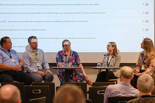
Simon Barlow, Executive Director of GeoPlace kicked off the afternoon’s lightning session, explaining a new format for this conference session: seven speakers, each delivering message-rich talk with seven slides in just seven minutes.
Recordings of the 2025 conference talks can be found here
SPEAKERS:
- Simon Barlow, Executive Director of GeoPlace
- Joseph Leach, Data Architect, London Borough of Tower Hamlets
- William Concordia, Database Administrator/Applications Lead
- Timothy Langner Gazetteer Officer at The Royal Borough of Kingston upon Thames
- Chris Manuel, Community Resilience Lead Officer, Wiltshire & Swindon Prepared
- Kristina Quinnell, Senior Geospatial Analyst & Custodian and Heather Porter, Data and GIS Manager, Reading Borough Council
- Graham Holland, Strategic Lead for Planning, Tameside Metropolitan Borough Council
- Frank Blades, Cyngor Sir Ceredigion County Council

Simon Barlow, Executive Director of GeoPlace kicked off the afternoon’s lightning session, explaining a new format for this conference session: seven speakers, each delivering message-rich talk with seven slides in just seven minutes. With a countdown clock visible to each speaker, the pressure was on — but the tone remained upbeat and supportive. Barlow invited the audience to listen not just for information, but for insight. “Understand their journeys,” he said, “and what they’ve learned. We hope it inspires you to try something different.”
Joseph Leach, Data Architect, London Borough of Tower Hamlets
Joseph opened with an unexpected subject: school dinners. Behind this everyday topic lay a data practitioner's methodology using property data that could shape national policy. In Tower Hamlets, free school meals are provided to all children — not just in primary schools, but across all schools in the borough. This universal provision, while progressive, introduced two key challenges. First: without families applying for meals, how could schools retain their eligibility for the Pupil Premium — funding allocated based on free school meal uptake? And second: how could the council evaluate whether the initiative actually improved outcomes?

To address the first problem, Joe’s team implemented auto-enrolment into the Pupil Premium using property data — identifying eligible households without requiring an application. Councils like Lewisham had pioneered a similar approach using a probabilistic matching tool called Splink, developed by the Ministry of Justice. Tower Hamlets instead opted for a deterministic approach using a tool called Assign, developed by Endeavour Health.
Assign allows councils to batch-process high volumes of free-text addresses, matching them to official property references using AddressBase Premium. It also supports de-identification — essential for combining sensitive datasets from health and education without breaching privacy.
Joseph explained how this method enabled researchers to link data from three key sources:
1. School rolls (covering attendance and attainment)
2. GP registration records, measuring local healthcare usage
3. The National Child Measurement Programme, tracking Body Mass Index (BMI) at reception and Year 6
Using Assign, addresses in these datasets were matched and then encrypted to produce a Residential Anonymised Linking Field (RALF). The same encryption key, held securely by a trusted party, was applied across datasets — meaning that even when data came from different organisations (such as the NHS and local authorities), matching RALFs could be used for anonymised research.
This process allows researchers to track changes in children’s health and education over time, while fully preserving individual privacy. By comparing BMI, school attendance, and attainment in areas with and without universal free school meals, this method can begin to assess whether the intervention has measurable benefits. “Lots of people don’t even know they’re eligible for services,” Joe said. “But councils do. And we can use data — responsibly and securely — to make a real difference.”
His presentation was a model of how smart data matching, grounded in property references and privacy-aware methods, can bring real-world insight to complex social questions.
William Concordia, London Borough of Lewisham
William Concordia, Data Specialist at the London Borough of Lewisham, presented a practical case study on how the council is using geospatial data and integrated systems to improve the management of public assets.

Lewisham is a borough known for its diversity and creativity — and, increasingly, for its use of digital tools in local government. The goal, William explained, is to better manage data across the council’s many systems by linking key assets held by the regeneration team with the Local Land and Property Gazetteer (LLPG) and the borough’s Land Registry records.
Working with LLPG vendors, the team developed tailored tools within their GIS application. The result: a more streamlined and accurate way to view, update, and manage Lewisham-owned properties across multiple departments.
William demonstrated the tool in action. After logging in, users are presented with two key menus:
• Asset Register, which manages general fund properties owned by the council
• Land Terrier, which displays all Lewisham-owned assets referenced via Land Registry titles.
Within the Asset Register, every property is linked via UPRN, land title, and address. New assets can be added manually, and existing ones can be searched using criteria such as category — for example, filtering by ‘commercial’ to reveal all relevant holdings.
Clicking on a record opens a detailed editing screen. This exposes a wide array of data fields relevant to multiple teams — planning, housing, parking, accounts — helping ensure that all departments are working from a shared, consistent data source. A live map view also displays the asset's exact location and ownership details, and scrollable panels show related LLPG entries and rental agreements. If multiple titles exist within the same area, users can drill down further to access linked records, attach planning documents, or update Land Registry data directly. Another feature allows searches by estate name or street address, returning precise geospatial and legal information about any site.
In the Land Terrier menu, users can search all registered council-owned assets by land title or reference number. This ties Land Registry titles directly to the relevant, offering a joined-up view that supports property oversight, legal checks, and boundary clarity. If a property has been sold, that too is indicated — a vital detail for teams managing the council’s portfolio. “These tools have significantly improved how we manage assets,” William said. “They offer richer information for contractors, keep internal teams aligned, and ensure our data is constantly refreshed from the LLPG.”
By creating a centralised, map-driven system linked to official registers, Lewisham is improving transparency and operational efficiency — while building a stronger foundation for resident services.
“Thanks everyone,” William concluded. “It’s good to show the data actually being used in the application — something that’s often talked about, but not always seen.”
Timothy Langner, GAIA Team, Royal Borough of Kingston upon Thames and London Borough of Sutton
Tim Langner, representing the shared digital GAIA team for Kingston and Sutton, delivered a compelling case study on the critical role of accurate address data — not just for digital records, but for democracy, service delivery, and government funding.

Tim began by underlining the civic value of address accuracy. “Agile addressing,” he explained, supports everything from emergency response times to parcel delivery, school places, and fair funding from central government. Without accurate address data, a council simply doesn’t know how many people live in its borough — and risks falling short in everything from healthcare planning to ward boundaries.
This became particularly urgent in the run-up to the national census. The Kingston and Sutton Gazetteer team had already won a GeoPlace Exemplar Award for their work in locating and integrating missing residential addresses. That work continued, Tim said, as the census required a complete and precise address index — vital not only for accurate population statistics, but also for the allocation of future funding.
The challenge was daunting. Despite both boroughs having tens of thousands of recorded addresses, many property types were underrepresented or missing entirely. Among the hardest to capture:
• Student halls of residence, especially third-party owned
• Houses in multiple occupation (HMOs)
• Houseboats
• Sheltered accommodation
• Traveller sites
Many of these properties, Tim noted, fell between departmental gaps. Some were never street named or numbered. Others had ambiguous or outdated records, and some weren’t formally recognised at all — leading to overextended services and undercounted populations.
The team approached the task methodically, breaking it down by property type and launching a coordinated investigation across departments. Communication was key: contacting licensing teams, universities, mooring owners, electoral registration officers, and planning teams to piece together a complete picture.
Kingston University played a pivotal role by sharing data on both university-managed and private student accommodation. Historic records were revisited to reconcile discrepancies in street naming. For houseboats, site visits and direct contact with mooring operators helped assign proper UPRNs. In the case of HMOs, access to floorplans allowed the team to address individual units and even record floor levels. This work was done without dedicated funding — folded into the team’s business-as-usual workload, amid ongoing team restructures. But the outcomes were transformative:
• Electoral improvements: Three new electoral wards were created to reflect the real population, and all boundaries were updated to ensure proportional representation
• Healthcare planning: More accurate population data helped inform the required capacity of GP surgeries
• School services: Better visibility of young residents improved school funding allocations and placement strategies
• Emergency response: Full address coverage meant better preparedness and access for emergency services
• Transport modelling: Newly discovered addresses led to re-evaluations of traffic load, parking provision, and road sensitivity
Just as important were the internal changes. Systems that once operated in silos — licensing, electoral services, council tax — began integrating with the address gazetteer. Licensing teams now receive daily updates; match rates across systems that once sat around 30% have dramatically improved. The results even impacted census participation: Tim credited the improvements with contributing to an almost 96% digital response rate.
“This work shows what’s possible with collaboration and focus,” he concluded. “For anyone who thinks their address data is ‘good enough’ — this work showcases why it matters.”
Chris Manuel, Community Resilience Lead Officer, Wiltshire & Swindon Local Resilience Forum
Chris Manuel brought a refreshingly honest and practical perspective to the conference — not from a data background, but from the frontline of emergency planning and community resilience. His role, he explained, is not about building datasets, but about ensuring an effective response when crises unfold. “We used to share photos of hand-drawn maps,” he admitted, describing the disjointed, analogue nature of data-sharing in past emergencies. Even today, data might still be exchanged via pictures of handwritten notes or screenshots of mismatched systems — hardly ideal in a crisis.

The core challenge was how to bring together vital data, quickly and consistently, across more than 30 agencies involved in the local resilience forum. And each had their own way of mapping, naming, formatting — or guarding — the information. At the heart of the problem was inconsistency. Free-text addresses in a hundred messy formats — often with different styles within the same organisation:
• Eastings and northings
• Grid references
• Latitude/longitude
• What3Words
• UPRNs
Data relating to vulnerable person— the kind needed most urgently in an emergency — was particularly scattered and sensitive. In just one local authority, five different teams held separate datasets for vulnerable people, often in different systems, formats, and with differing permissions.
Chris confessed that, until a year ago, he’d never heard of a UPRN, but once he discovered it, it changed everything. “One property, one number — and you can’t spell it wrong,” he joked. That clarity was invaluable, especially when compared to free-text addresses, which vary wildly in capitalisation, punctuation, and structure. UPRNs, he explained, allowed emergency planners to avoid the data wrangling pitfalls of inconsistent or ambiguous address records. Crucially, they also reassured organisations worried about GDPR: linking data to a property, not a person, sidestepped many privacy concerns while still enabling action.
Working with Ordnance Survey, Chris’s team began building a model that brought together known datasets using UPRNs as the consistent anchor. Vulnerable data could be overlaid securely onto this spatial framework — enabling planners to see, at a glance, where support might be needed in a crisis.
Data could now be submitted in two ways:
1. Manual upload using a standard template (green dots representing original records, with coloured zones showing vulnerable overlays)
2. Automated data transfer (a work in progress).
“Most people in my field still don’t know what a UPRN is,” Chris said, “and that’s fine — they don’t need to. It’s behind the scenes. But it makes the whole system work.” He noted that many vulnerable datasets already contain UPRNs, and because many councils use the same software providers, integration is becoming smoother. It’s still early days, but even partial progress has made a dramatic difference: where once data was scattered and fragile, it is now starting to become structured, stable, and usable under pressure.
Is it perfect? No, he said plainly. But compared to the past — “spreadsheet chaos, or photos of scribbled maps” — the current system is a major step forward.
Kristina Quinnell and Heather Porter, Reading Borough Council
Kristina Quinnell and Heather Porter took delegates through Reading Council’s evolving journey — one grounded in integrating UPRNs and optimising the GIS infrastructure that supports services across the local authority.

Their Data and GIS team is a joint unit responsible for data analytics, GIS, street naming and numbering, and management of the LLPG (Local Land and Property Gazetteer) and LSG (Local Street Gazetteer). Sitting within the council’s wider Resources Directorate, the team acts as a corporate hub, enabling services to connect and operate using shared spatial intelligence.
Over the past few years, they have rebuilt their technical stack to enable greater connectivity and interoperability across systems. A key pillar of this work has been their Postgres database, now the central reference source for all spatial data. When paired with GeoServer and FME, the team is now able to connect to, and draw from, a wide variety of systems — reducing duplication, standardising data, and breaking down silos.
They referenced the well-known GeoPlace integration diagram and shared Reading’s version — proudly noting a significant improvement in connectivity over the past year, particularly across CRM, land charges, planning control, and other services. One major project, for example is the council’s shift to Arcus Global (built on Salesforce) as a new CRM and planning system.
Unlike the old system — which saved application extents into MapInfo tab files — the new platform supports direct database integration. Now, planning data is drawn, saved via GeoServer and API, and lands in Postgres, forming part of a coherent, centralised data model. The new system also supports direct linking to the LLPG for in-borough addresses and uses OS Places for out-of-borough records.
However, legacy constraints remain. For example, the land charges system still can’t consume APIs and won’t for another two years. To bridge that gap, the team built an ETL process using FME that extracts data from Postgres, transforms it into MapInfo format, and delivers it daily via SFTP to be consumed by the land charges system. It’s not elegant — but it works.
Heather highlighted another key learning: many integrations fall short not because of internal failure, but because external systems are not yet API-ready. A standout example was their attempt to integrate LLPG data into the education platform — which still required regular ingestion of out-of-borough data. Initially, they relied on a manual OS Data Hub download process, triggered by a calendar reminder. It was easily forgotten. With FME now in place, they have automated the process: the OS Downloads API fetches the data, FME processes and places it correctly, and the system admin is emailed when it’s ready. The result is cleaner, more frequent data refreshes — and no more forgotten updates.
Kristina shared an AI proof-of-concept project from her apprenticeship. Responding to issues raised by Highways (such as utilities digging up road markings and councils lacking accessible records to help reinstate them), she trained a model to detect four types of road markings from PG-B aerial imagery.
Where previously the council had spent £x on car surveys to supply this data (e.g. for traffic lights and pedestrian crossings), Kristina AI model cost just pounds, and even detected five zebra crossings that had been missed during the car-based survey. While scaling the model to borough level isn’t currently viable due to training data requirements, she proposed it as a potential national initiative for GeoPlace or others to take forward.
Graham Holland, Strategic Lead for Planning, Tameside Metropolitan Borough Council
As Strategic Lead for Planning at Tameside, Graham oversees a team of planners and transport planners, supported by in-house GIS expertise and the LLPG role. Located on the edge of the Peak District in Greater Manchester, the council faces unique planning and environmental challenges — from ambitious development zones to flash flooding events at the top of major river catchments.

A few years ago, performance against LLPG indicators wasn’t where it needed to be. Tameside took a strategic step, bringing the LLPG role into the Planning Service itself – embedding it alongside people who understand the day-to-day of planning and building control to create a stronger foundation for improvement. That integration paid off. By the time of this year’s GeoPlace conference, Tameside had reached Gold Status across all indicators. But Graham was candid: despite this success, they’re still at Level 2 integration — with plenty of red still showing on their connectivity spider diagram.
To move forward, the council established a dedicated project team with corporate backing, including senior sponsorship from Graham’s director and support from finance and information governance. By bringing in external consultants, they sought to help clarify the integration landscape and build a compelling business case. One particularly effective approach was a day of ‘service speed dating’ — short, focused meetings with six different service areas to explore how each interacts with address data. This helped surface quick wins, technical blocks, and shared needs across the council. Progress was made quickly in some areas — like planning and building control — while others (like council tax and CRM) presented challenges due to external systems or in-progress procurements.
What emerged from this work was not just a clearer technical picture, but a quantifiable case for ROI. Graham outlined potential savings and efficiencies in key services:
• Social Care: Up to 5% savings in children’s and adults' services by using GIS to better allocate resources and optimise routing
• Waste Management: Up to 10% savings by Rreducing duplication and missed opportunities by dynamically updating collection routes and linking new builds — potentially deferring costly vehicle replacements
• School Transport: Estimated 10% cost reduction by aligning eligibility assessments, UPRN-linked data, and dynamic routing
The strength of the UPRN business case has now helped Tameside embed data integration into four corporate transformation workstreams, following an LGA peer review. The team appreciates the clarity of the GeoPlace standards and is using them to track and report progress. The goal is clear: turn good data into better services and financial resilience. Graham concluded with an open invitation: “We’re still on the journey. If you’re in the same place, let’s talk.”
Frank Blades, Data Team, Cyngor Sir Ceredigion County Council
For Frank Blades and the data team in Ceredigion, digital mapping isn’t just about lines on a page — it’s about delivering real value in one of Wales’s most rural and complex environments. From potholes to fly tipping, and affordable housing to seasonal tourism, the council wrestles with many of the classic challenges of public service, but with the added twist of vast geography, fragile infrastructure, and a transient property landscape shaped by holiday homes.
Frank focused on a single case to illustrate the power of joined-up, spatially enriched data: refuse collection. More specifically, identifying and excluding holiday homes from domestic waste pickup.
The problem in Ceredigion, is that holiday homes are a growing concern. By law, they must use commercial waste services, not council domestic collection. But for frontline operatives on winding rural routes, distinguishing a short-let from a full-time residence in real time has historically been near impossible.
That’s where the data team stepped in — building a mapping tool to empower waste operatives with GPS-enabled tablets mounted in collection vehicles. The tool allows crews to visually identify which properties are genuine residences, and which are commercial lets masquerading as homes.
The journey began with council tax data — valuable but not spatial. Using the UPRN as the key, Blades’ team merged this with OS AddressBase Core to give it geographic context. But they needed more: the elusive ‘holiday home’ classification.
That’s where OS NGD Built Address data made a difference. The CO (classification) attribute allowed the team to isolate holiday accommodation — though not all of it was relevant. By filtering out hotels, B&Bs, and other non-home categories using OS Building Use definitions, they honed in on the genuine short-term lets. To this, they added local insight:
• Planning department surveys for declared holiday builds
• Highways and Environmental Services intelligence for known cases on the ground
The result: a rich, spatially aware dataset of confirmed holiday homes, forming the basis for the Highways Domestic Collection Map. As an added bonus: this work also uncovered gaps in the LLPG. By identifying properties that weren’t previously classified correctly, the team could feed updates back — strengthening not just the waste service, but the council’s master address data.
Frank then went on to describe Ordnance Survey’s NGD as a “game-changer.” It enables polygon-level building footprints and lets them distinguish between mixed-use, residential, and trade buildings across the county. They created three new datasets using the NGD Recipe Builder, overlaying data to spot mismatches between council knowledge and real-world land use. On their final map, the colour-coded overlays tell the story:
• Purple points on pink polygons: known holiday homes in trade buildings
• Red points on green polygons: unknown holiday lets hidden in residential footprints — now flagged for operational review.
A working prototype now sits on an iPad mounted in the cab of a council vehicle. As Frank’s manager Matt drives through Aberystwyth, the app flags properties in real time — streamlining route decisions, reducing wasteful pickups, and ultimately cutting costs. Further testing is ongoing, but the plan is clear: deployment across refuse trucks later this year. And the goal is bigger than better bins — it’s about better data, better services, and better value for money.